
Low Lake Levels And The Importance Of Capturing The Storm
Trending
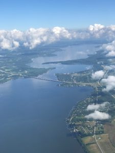
If you’ve been paying attention to recent local news, then you may have heard about the low level of Chautauqua Lake right now.
According to the U.S. Geological Survey on the morning of April 16th, Chautauqua Lake sat at just 1,307.59 feet above mean sea level (ft msl), even after a couple of days of rain. For comparison, the lowest level on record is 1,306.2 ft msl in 1998, and the optimum spring level, according to Warner Dam operational guidelines, is 1,308.2 ft msl.
Why is Chautauqua Lake so low? This question may seem simple at first -- we are in a moderate drought, low levels of precipitation mean less water in the lake and, therefore, water levels are low. In the most simplified terms, this is the problem. However, how water gets into our streams and lakes is surprisingly more complicated than that. One would intuitively think that the water we see flowing down a stream and into the lake during a rainstorm is coming from the sky as the rain falls directly into it. But can you believe this isn’t true for the majority of that water? In our recent webinar with Bryan Swistock, a senior extension associate with Penn State University, we learned that a significant portion of that water is actually coming from underground. The rain acts as a piston pushing the stored groundwater out into the stream. Very little of the water getting into the stream is coming directly from the rain. What all of this boils down to is that we need to have strong groundwater stores because our stream and lake levels depend heavily on them. The more stormwater we are able to capture underground, the more consistent the flow of our lake’s source waters will be.
At this point you may be thinking -- but what about the Warner Dam? Warner Dam is located in downtown Jamestown at Chautauqua Lake’s outlet to the Chadakoin River. Many people assume that Warner Dam can control the level of Chautauqua Lake. However, the primary purpose of the dam is to reduce flood damage, and therefore its influence is actually quite limited. Each spring in April, water flow through the dam is reduced to help raise lake levels to the optimum 1,308.25 ft msl, and then it is increased in late October to lower the levels in preparation for winter snow melt and spring rain events. I reached out to Dave McCoy, the Chautauqua County watershed coordinator, for a little help understanding how this worked and what the dam is actually doing right now. He explained that “the dam is releasing water at a rate of 40 cubic feet per second” and “the historic mean for flow through the dam is between 800 and 900 cubic feet per second.” This means that we are at 20 times less flow than the historic mean. Mr. McCoy also explained that “40 cubic feet per second is the minimum flow required to keep the Chadakoin River below the dam alive,” which is important for that habitat’s fish and wildlife. So in all, the dam is helpful during times of flooding, but there isn’t much it can do to help us out in times of drought like we are currently experiencing.
So what can we do to help? If our lake’s water primarily comes from its surrounding streams, which are fueled by our watershed’s groundwater stores, then it makes sense to help bolster those groundwater stores in order to support more consistent lake levels during times of drought. We can all help by “capturing the storm.” Groundwater stores are replenished by water that filters down through the ground. In order to do so, the water needs to be slowed and “captured” long enough for infiltration and absorption to take place. I’ll bet you can see where this is going.
To slow the water down, we need plants! Not all ground is created equal when it comes to slowing down and absorbing water. Forests are the very best at this. Their spongy ground with beds of decaying leaf litter and natural aeration from insects is unbeatable at capturing that water and letting it percolate down to our groundwater stores. Don’t have room for a forest on your property? That’s okay! The overall goal is to limit the amount of impervious surfaces you have. This could mean simply mowing your grass taller so that it is better at catching the rain. Or better yet, shrink the size of your mowed lawn, leaving areas on the downside of your property to act as a buffer and capture the water and help it absorb before reaching the street. Anything you can do to add vegetation and limit runoff will help.
Restoring our groundwater levels takes time, but we can all make a difference for our lakes by working together to capture the storm.
The Chautauqua Watershed Conservancy is a not-for-profit organization with the mission to preserve and enhance the water quality, scenic beauty and ecological health of the lakes, streams, wetlands and watersheds of the Chautauqua region. For more information, visit chautauquawatershed.org and follow us on Facebook and Instagram.