
What’s in city’s Safe Streets For All projects
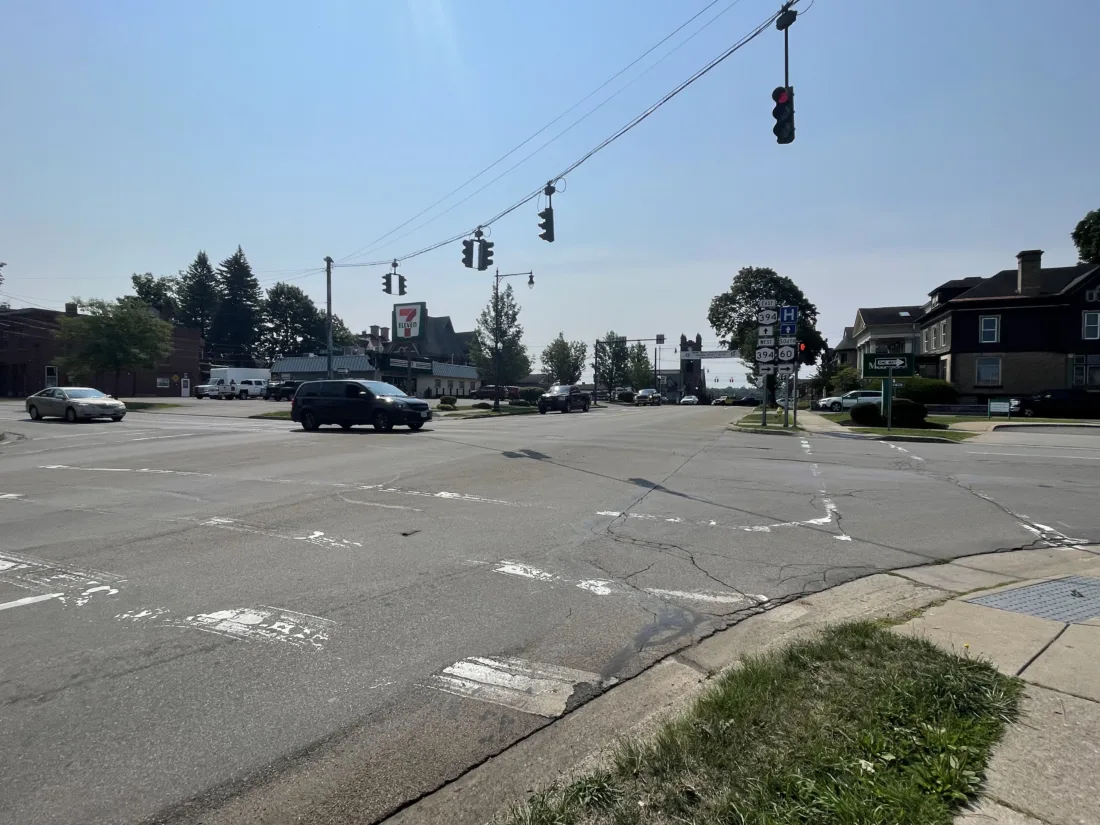
Both Main and Sixth streets could see changes under the city’s Safe Streets for All project. The turn lane at Sixth and Main streets could be removed while some parking spaces on Main Street could be removed. Main Street could also see reallocating one of the existing northbound traffic lanes to create one northbound driving lane and one southbound driving lane plus either a left turn lane or a refuge island. P-J photo by John Whittaker
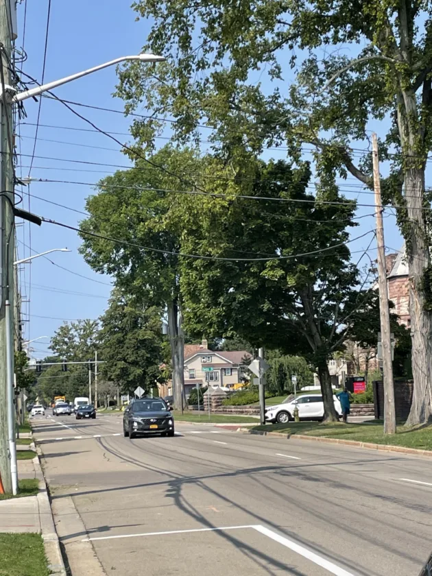
Traffic moves along Fifth Street on Friday. Fifth and Sixth streets could see buffered bike lanes added to the road along with having lanes removed. P-J photo by John Whittaker
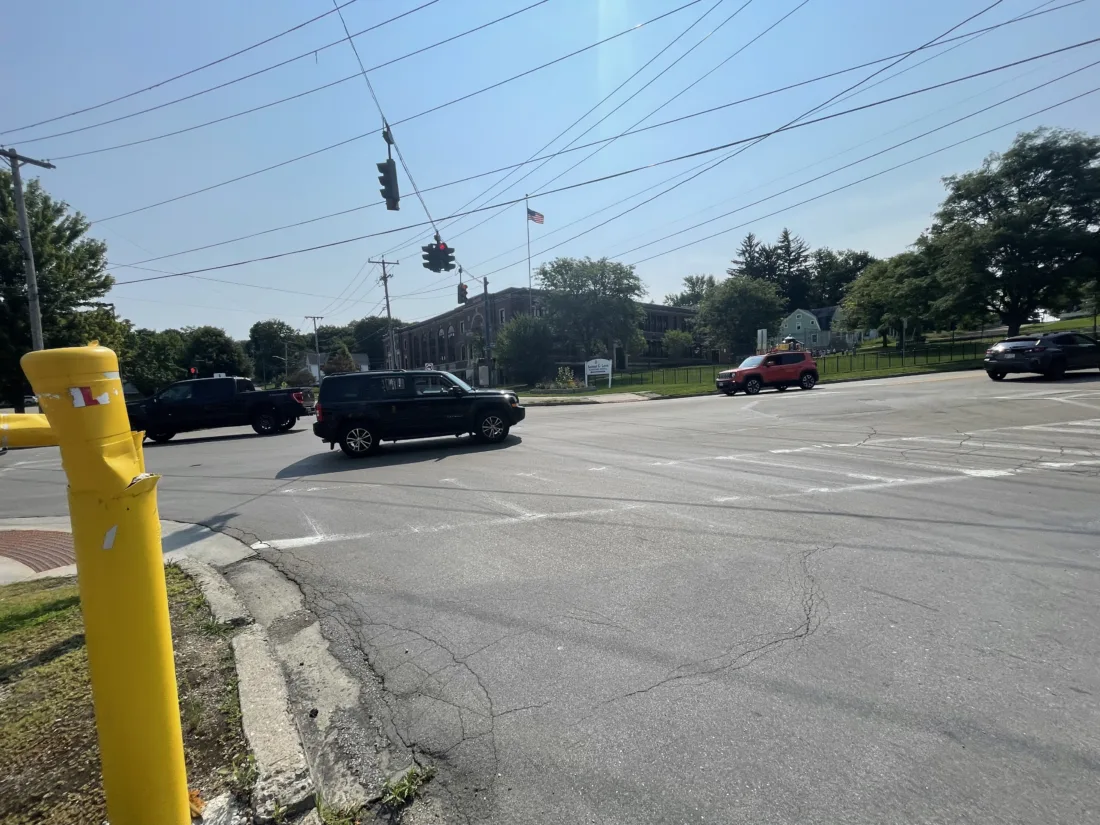
Traffic is pictured passing through the intersection of Eighth and Main streets on Friday. Changes for the intersection discussed in the city’s Safe Streets for All project include giving pedestrians more time to cross before vehicles receive a green light as well as pulling back the southbound stop bar for better pedestrian visibility. The alignment of the street north of the intersection could be changed with existing curblines to improve alignment through the intersection. P-J photo by John Whittaker
Both Main and Sixth streets could see changes under the city’s Safe Streets for All project. The turn lane at Sixth and Main streets could be removed while some parking spaces on Main Street could be removed. Main Street could also see reallocating one of the existing northbound traffic lanes to create one northbound driving lane and one southbound driving lane plus either a left turn lane or a refuge island. P-J photo by John Whittaker
Traffic moves along Fifth Street on Friday. Fifth and Sixth streets could see buffered bike lanes added to the road along with having lanes removed. P-J photo by John Whittaker
Traffic is pictured passing through the intersection of Eighth and Main streets on Friday. Changes for the intersection discussed in the city’s Safe Streets for All project include giving pedestrians more time to cross before vehicles receive a green light as well as pulling back the southbound stop bar for better pedestrian visibility. The alignment of the street north of the intersection could be changed with existing curblines to improve alignment through the intersection. P-J photo by John Whittaker
Trending
Jamestown’s Safe Streets for All Plan will take its turn on center stage in the next two weeks.
The plan is scheduled for discussion at this week’s Planning Commission meeting as well as at an Aug. 26 meeting starting at 5 p.m. at the James Prendergast Library.
So, what’s in the plan?
There are nine potential project locations identified so far. Here’s what’s up for discussion at public meetings over the next couple of weeks.
MAIN STREET
Main Street from Second to Sixth streets is an area that has seen four injuries involving fatalities or serious injuries. Possible improvements under discussion include reallocating one of the existing northbound traffic lanes to create one northbound driving lane and one southbound driving lane plus either a left turn lane or a refuge island. It’s also being proposed to review on-street parking spaces to ensure cross-walk visibility, install markings that restrict parking near intersections and installing vertical elements in place of any removed parking spaces. At Sixth Street, planners are considering improving southbound alignment by removing the southbound right turn lane. Short-term projects also include installation of 360-degree cameras to capture vehicles, pedestrians and cyclists.
Longer-term projects include installing pedestrian bulb-outs at intersections and redesigning pedestrian ramps on Second, Third and Fourth streets, as feasible. A two-way bikeway on Main Street between the Chadakoin Riverwalk and Second Street could be a possibility to allow bike access to Washington Street’s buffered bike lanes from the Riverwalk.
WEST FIFTH, SIXTH STREETS
Short-term improvements on Sixth Street could include a buffered bike lane with potential separators on the south side of the street and restriping with one westbound motor vehicle lane. Daylighting markings could be added for intersection approaches in place of turn lanes, with parking allowed on the north side of the street west of Washington Street. On Fifth Street, the plan includes a buffered bike lane with potential separators on the north side of Fifth Street and restriping of one eastbound vehicle lane, except at signalized approaches to Washington Street and Prendergast Avenue.
There are two options for longer-term improvements. The first is construction of raised one-way protected bike lane on both Fifth and Sixth streets while retaining one-way vehicle traffic.
A second possible change is to consolidate Route 394 to Fifth Street and convert Fifth Street to two-way traffic. Sixth Street would then be converted to a quiet street with low volume, two-way operation with robust traffic calming treatments that include no through-traffic intersections. The block of Sixth Street from Fairmount Avenue to Fifth Street would be closed under this plan with traffic lanes reassigned on Prendergast Avenue.
THIRD AND FOURTH STREETS
Potential improvements to the intersection of Third and Fourth streets, intersection Fairmount Avenue, include terminating Fourth Street at Monroe Street and eliminating Martine Alley. There is discussion of realigning the southern end of Fairmount Avenue to be more perpendicular to Third Street and concert it to right in and right out, with Fairmount converted from one way into a two-way street. Changes to the area could also include installation of expanded green space island if Fourth Street between Monroe and Third streets is eliminated. Gateway features could be included in the new pocket park. Traffic control would change from a stop sign on Third Street traveling west to a stop control on Fairmount. The pedestrian crossing at Fairmount would change to a rectangular rapid flashing beacon activated crosswalk. Finally, a median island would be installed on Third Street.
MAIN AND EIGHTH
One change would be aimed at giving pedestrians more time to cross before vehicles receive a green light as well as pulling back the southbound stop bar for better pedestrian visibility. The alignment of the street north of the intersection could be changed with existing curblines to improve alignment through the intersection. There is also a recommendation to consider turn calming with mountable elements to reduce turn speeds while accommodating right-turning trucks, especially trucks turning west.
FOURTH STREET
Recommendations for Fourth Street from Clinton Street to Prendergast Avenue include concerting the existing one-way segment to two-way operation, with one 11-foot wide travel lane in each direction and a 10-foot wide refuge island at the intersections. The plan also includes possible pedestrian bulb-outs at key intersections, expanded sidewalks in front of businesses with successful parklets and street eateries, and retaining westbound-only operation between Clinton and Monroe streets.
FOOTE AVENUE
Foote Avenue from Allen Street to Cole Avenue could see major changes in both the short- and long-terms. Short-term improvements could include high-visibility crosswalks at Foote and Allen streets with accessible pedestrian signals with push buttons. Foote Avenue and Prather Street would receive high-visibility crosswalks, stop lines on Prather and intersection crosswalks across Foote Avenue. At Foote and Arnold, the plan includes detectable warning strips at curb ramps, improving visibility of the curb ramp located within the tree/park area using signs or markings.
Foote and Newland would see push button pedestrian signals added as well as signal backplates and improved directional curb ramps to point at the crosswalk instead of the street. Foote and Cole would see push-button pedestrian signals installed, signal backplates added and a change to no turn on red restrictions and leading pedestrian intervals at all signals. Finally,from Washington Street to Cole Avenue, Foote Avenue could be narrowed from five lanes to three lanes by restriping outside motor vehicle lanes into buffered bike lanes and supplementing it with vertical separation.
Long term improvements include a raised intersection at Foote and Prather, redesigning the Foote and Washington intersection to remove free-flow northbound movement on Foote Avenue and shift movements to be signal controlled. A center median pedestrian refuge could be installed to support safer crossing of Foote Avenue. At Foote and Ivy, the road could be redesigned to “tee off” the Ivy approach to Foote Avenue with raised crossing where existing curb ramps are located. Washington Street to Cole could also see a narrowed roadway with widened grass areas, added shoulders and a widened sidewalk to a minimum of eight feet for pedestrian and bicycle traffic.
WASHINGTON STREET AND MAIN STREET INTERSECTION
Short-term projects are minor in scope – video detection and pedestrian signals, signal backplates and an all-pedestrian phase. A narrower right turn slip ramp could be installed with paint and post curb extensions, a curbed pedestrian island on the northbound Main Street approach and an improved curb ramp at the “New Creation Assembly of God” triangle.
Long-term improvements could be major projects. One possibility is to break the intersection into two signals, though that could eliminate direct access to Prospect Street. A second option could include a roundabout at the intersection, though land would likely have to be acquired for that to happen.
FALCONER STREET
Falconer Street from Winsor Street to Lillian Dickson Park could see short-term improvements like speed humps or speed cushions to slow vehicle traffic along with improved curb ramps that would include modern detectable warning systems and layouts. A high visibility crosswalk and/or rectangular rapid flashing beacons near the entrance to the park and on each leg of the Bowen Street intersection are also under consideration.
A longer term project could include a neighborhood traffic circle or raised intersection at Bowen Street.
NEWLAND AVENUE
-Newland Avenue could see additional stop controls on what is largely an unsignalized street. Curb extensions, speed feedback signs, speed bumps and speed cushions, high-visibility crosswalk markings and additional street trees are all among short-term improvements.
Long-term, the plan includes the possibility of a neighborhood traffic circle or a raised intersection at Bowen Street.