City Looks For Public Input On Safe Streets
The city’s Safe Streets For All initiative is continuing to move forward, and part of moving forward is looking for community engagement to help make streets in the city safe for everyone.
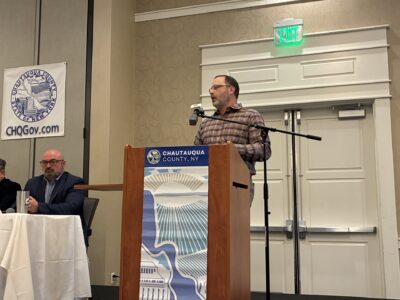
City Planner Jason Kulaszewski gave an update to the Planning Commission recently about the initiative, including that a second steering committee meeting has been held with a focus now on public engagement.
A website has been set up, jamestownny.gov/safe-streets-4-all, and the commission was also given a QR code to take people directly to the feedback form.
“Essentially what we’re looking for is just feedback about places, areas throughout the city where there may be traffic- or pedestrian-related issues that we could fix or consider during this process,” Kulaszewski said.
Kulaszewski added that there will be 13 different locations that get some sort of design work done through this process, along with improvements made to pedestrian and street infrastructure. The website also includes a map where someone is able to “drop a pin” for specific locations and say what the issues are there.
“This is a way for us to engage with the public around the Safe Streets For All planning process,” Kulaszewski said. “We will have some events, and part of our steering committee meeting tomorrow will be to identify events where we will be out in the public throughout the summer.”
A few events are already being planned with the Prendergast Library, including participating in the library’s Community Days, which are held on Wednesdays throughout the summer. Kulaszewski said they will also be there for the library’s Community Block Party on June 27.
Kulaszewski added that the plan is to get feedback for the city’s Comprehensive Plan at these events as well. The hope following the next steering committee meeting is to begin to have a map and some initial ideas from the early feedback they have received from the public. This is specifically to have maps of areas of the city with higher pedestrian- and vehicle-related incidents.
“We will be kind of using them as conversation starters when we’re out in the community, just to get verification that folks feel that these are the right places to be looking at or if there’s other suggestions,” Kulaszewski said. “We definitely want to take those other suggestions into consideration as well, because the planning process that will be happening over the rest of the year, this year will hopefully lead to funding so that we can implement projects we are identifying through this planning process.”
It was also noted by the Planning Commission that it is important to make sure people understand that some streets are city-owned and others are county or state-owned, and Kulaszewski said there will be identifiers on the maps that will say that. That is also something he said he will facilitate into conversations in the community.
“I will say this isn’t only about the city-owned streets, this is about the entire transportation network,” Kulaszewski said. “So if there are issues on city, county or state-owned roads we want to take all of that information into consideration too. The state and the county are doing road projects here and if there’s an opportunity to improve upon design or add additional safety elements we want to be able to communicate that with them too.”
A question was asked about potholes being included in these plans, which Kulaszewski said is more of a maintenance issue, but some maintenance issues could be included in the plans, such as sidewalk maintenance. Kulaszewski said when sidewalks are not maintained then pedestrians walk in the streets, leading to more pedestrian- and vehicle-related incidents. Infrastructure recommendations are likely to come from these plans as well.
Kulaszewski noted that the feedback form will explain what Safe Streets For All is and then the feedback will go towards the planning process, so people will know that it is not something to use to get something like potholes fixed. He said while a pothole could be reported and then passed on to the Department of Public Works, there is no guaranteed turn around time for something like that if reported through this feedback, and language explaining that could be put on the website. There is also already a pothole porthole on the city’s website where people are able to go to report those, and Kulaszewski said maybe it would be possible to even link those two together for a road concern that needs immediate attention, so that information goes to the right place.
The Safe Streets For All feedback will be for things like signs as well, and Kulaszewski said already some initial feedback has been in regards to the needs for stop signs or similar signs in some specific spots. This also includes other types of intervention like crosswalks, signage, narrowing the road, bike lanes, and lighting. Any non-road pathways such as ideas that have already been pitched by Jamestown Community College, including looking at Rails to Trails or extending the Riverwalk so students do not have to walk down Second Street can also be taken into consideration.
“Any of those types of things can be suggestions taken into consideration in the planning process,” Kulaszewski said. “Not all of them may make it to paper, but it’s at least good for us in the planning and DOD to hear those things so as we are pursuing new funding and different things that we are also understanding what the community wants and sees out there.”
Top stories
City Looks For Public Input On Safe Streets
The city’s Safe Streets For All initiative is continuing to move forward, and part of moving forward is looking ...
Plan Comes Together: Five-Year Lake Management Recommendations Given By NCSU
Person In Custody After Incident In Dunkirk

Trustees Hear Update On Missing Lakewood Man

Two Charged After Puppy Found Dead, Other Pets In Squalor
