FEMA To Host Community Meeting
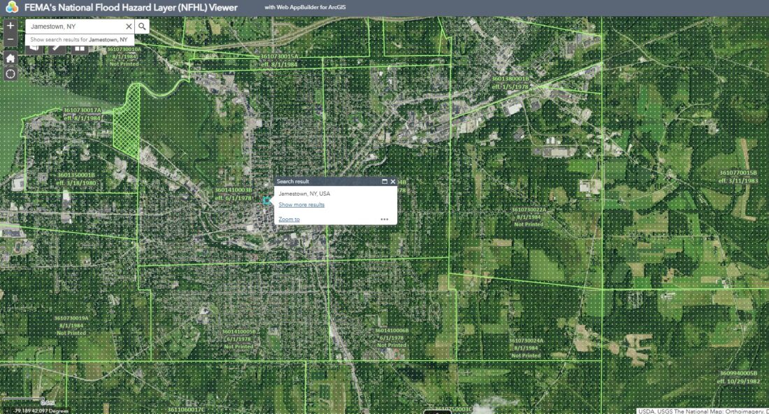
A Federal Emergency Management Agency (FEMA) topographical overlay map of Jamestown, New York flood plains. Submitted photo
CORRECTION: FEMA Meeting Is Virtual
A recent story in The Post-Journal, “FEMA To Host Community Meeting” incorrectly lists the date of an in-person meeting at the James Prendergast Library. Representatives from FEMA will be hosting a virtual meeting on July 31, from 3 to 6 p.m. in the Fireplace Room of the James Prendergast Library.
The Federal Emergency Management Agency (FEMA) will conduct an informative presentation on the newly redrawn and revised floodplains for the area.
Representatives from FEMA will be hosting an informative community meeting on July 31, from 3 to 6 p.m. in the Fireplace Room of the James Prendergast Library. The meeting will focus on newly redrawn and designated floodplain areas, which align closely with the Wetlands maps provided by the New York State Department of Environmental Conservation.
The perceived intertwining of the two organizations, FEMA and NYSDEC, along with the introduction of newly redrawn topographical maps, has precipitated confusion and dissatisfaction among many residents in the area.
According to a March 11 story in the Post-Journal, Jeff Swanson, the code enforcement officer for building and zoning in Busti, stated, “I participated in a webinar with the DEC last Thursday, and I’m still confused.”
Swanson explained, “FEMA is in the process of redrawing floodplain maps, although this information has not yet been made public. If a residential or commercial property is located in a designated wetlands area and within a FEMA floodplain zone, it may require permits from both state and federal authorities.” He added, “For instance, if a property lies within a floodplain and the owner intends to construct a building, they must elevate the structure at least two feet above the designated flood zone level. Additionally, since the property is situated in a state-regulated wetlands area, the owner will need to complete a permit application and secure the necessary permissions to proceed with construction, along with covering any associated fees. It can all be quite perplexing.”
FEMA officials state that changing weather patterns and other factors have contributed to the need for redrawing the maps.
Between 2011 and 2021, Chautauqua County experienced four weather-related disasters, which resulted in the allocation of more than $2.2 million in federal recovery funds. Notably, FEMA distributed the largest portion of these funds–$818,000–to the flood-affected region in Cattaraugus County, which ultimately received more than $10.3 million in federal assistance. Furthermore, Chautauqua County received $350,000 in FEMA funds for a disaster declared in 2013 due to “severe storms and flooding,” $370,500 for a “severe winter storm, snowstorm, and flooding” in 2014, and $682,000 for “severe storms, straight-line winds, and flooding” in 2019.
Topics for the upcoming scheduled meeting will include the risk of flooding, potential changes to flood insurance, and the newly released maps.
Pre-registration for the event is encouraged. To register, visit: https://fema.zoomgov.com/meeting/register/Z9JJjOdlRNyT-V-G16MwRw#/.
For more information, contact a map specialist at the FEMA Mapping and Insurance eXchange (FMIX) at 877-336-2627 or FEMA-FMIX@fema.dhs.gov.
New York state is part of FEMA Region Two’s area of jurisdiction and oversight.
Local News

Education Upgrades: SWCS Construction Plans Progressing For 2026
YMCA To Begin Move To JCC
Clymer Looking For Little League Director
St. Luke’s To Screen Film Tonight At JCC
The St. Luke’s Episcopal Church’s Dismantling Racism Commission will be showing the award-winning film ...
Lakeside Park Project Hikes Mayville Budget